Our proposal
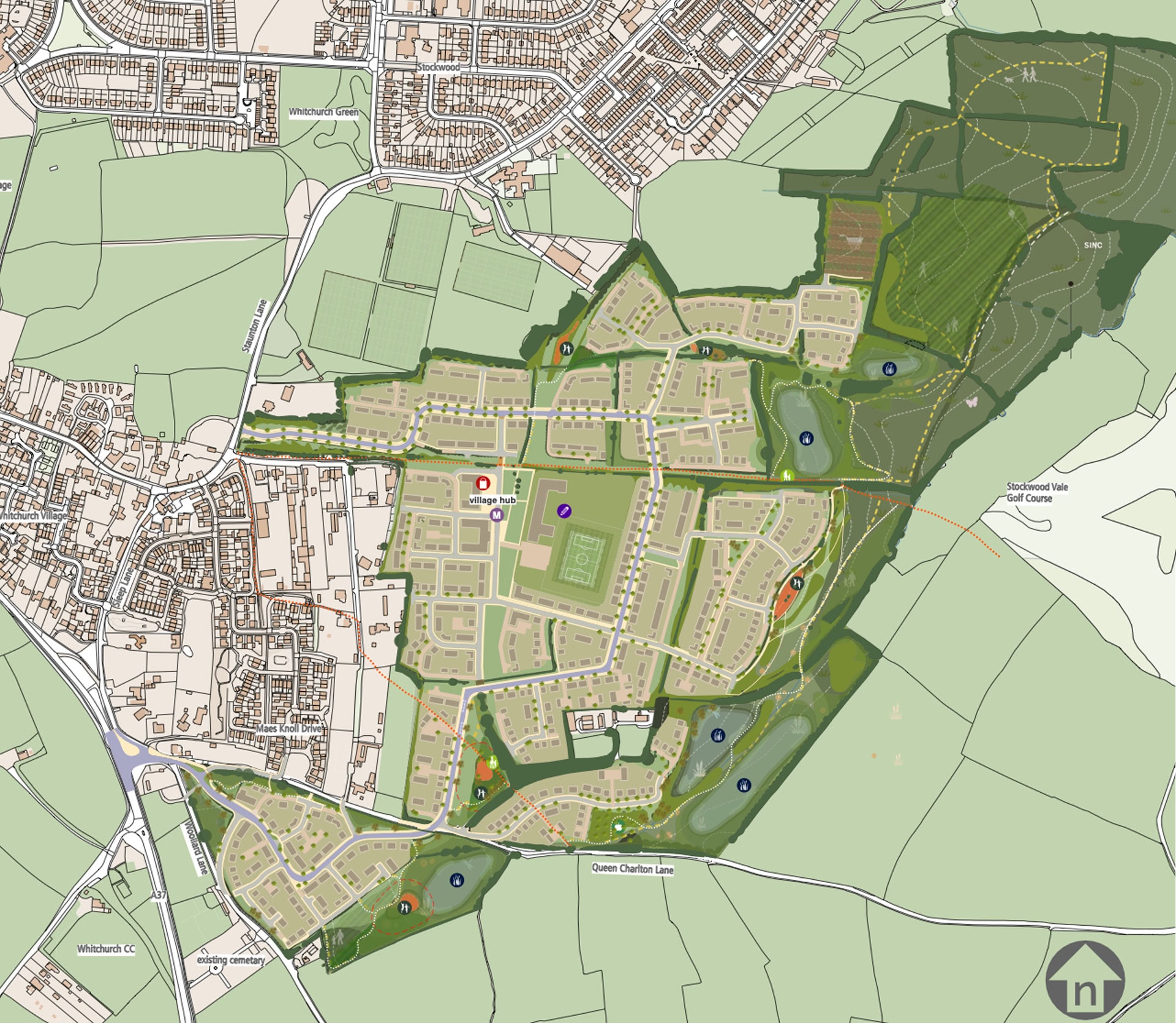
Draft Masterplan
Creating a new neighbourhood
- Approximately 1,000 new homes including a mix of types and tenures – including affordable – to meet identified housing need and create a balanced community
- A new primary school – including pre-school provision – in the heart of the new development and easily accessible to existing and future residents on foot
- A new local hub with the potential to incorporate a variety of uses such as a convenience store, café, work hub, healthcare facilities, community space, post office, etc., all of which would provide additional local services and facilities for both existing and future residents
- Approximately 37 ha of new areas of open spaces for leisure and recreation, including children’s play space, community growing areas such as allotments or orchards, and natural green spaces
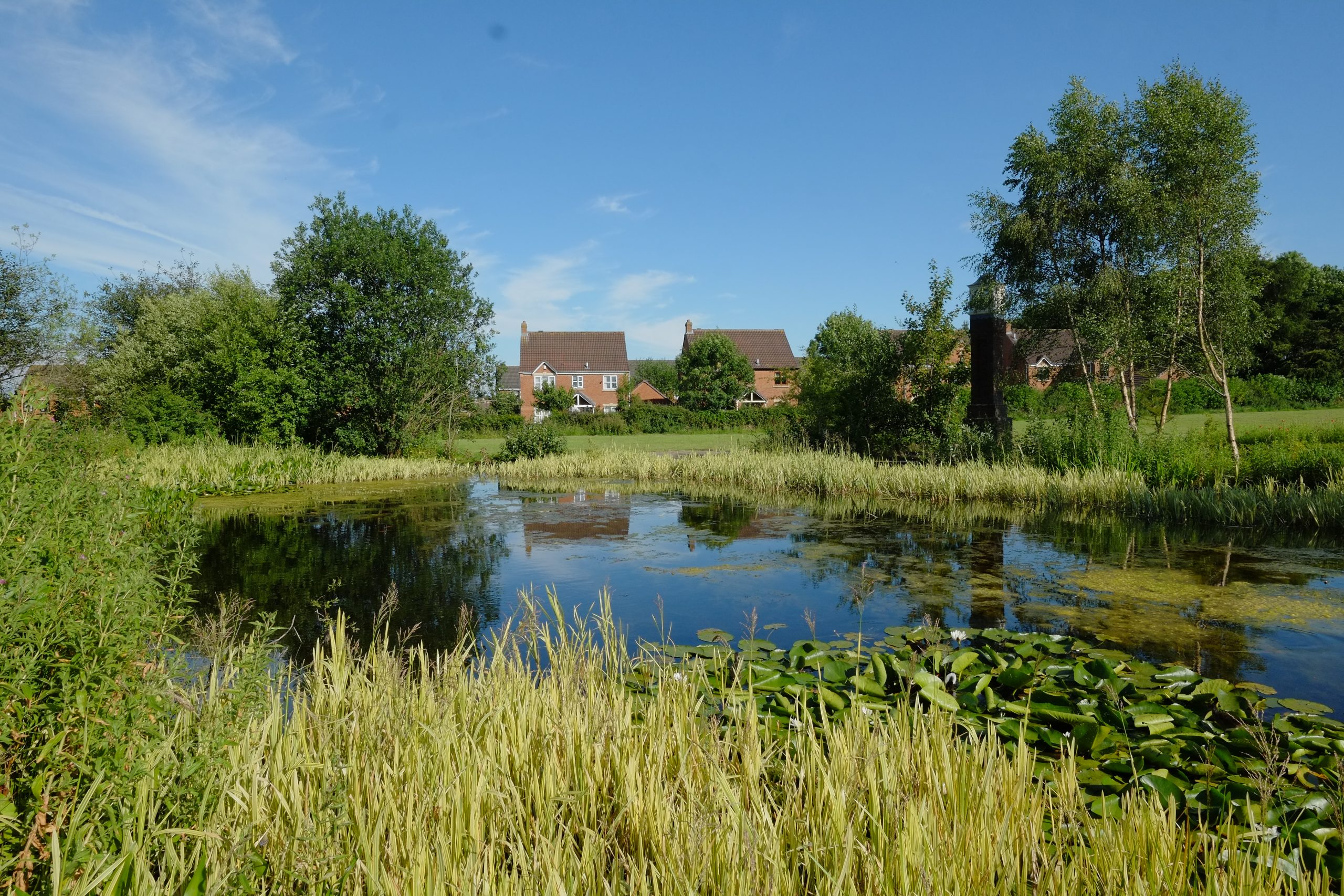
- More than half the site would remain open, green and community space with significant ecological enhancements
Landscape & ecology
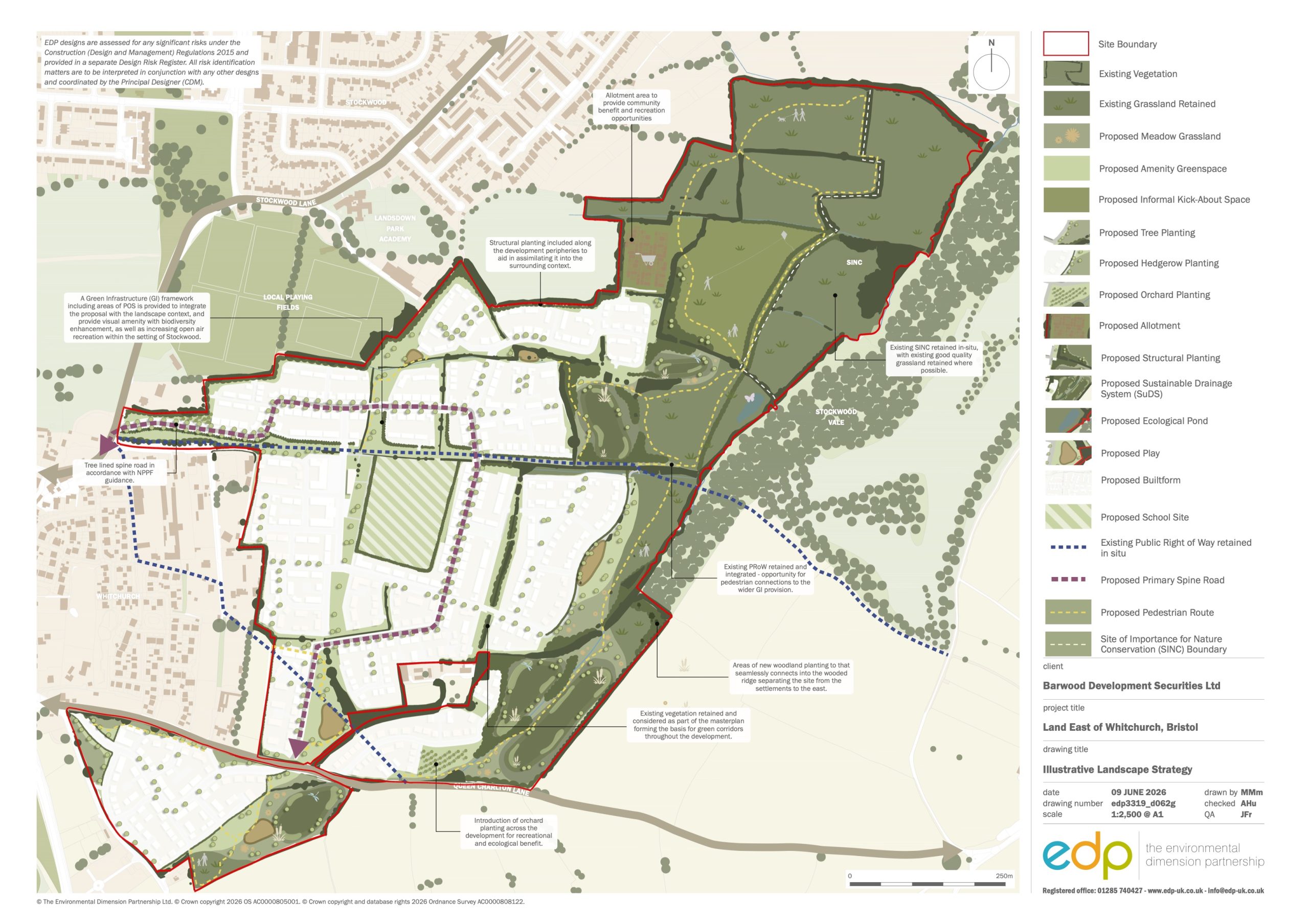
- Approximately half the site would remain as open green space, which will be managed and maintained and be publicly accessible in perpetuity
- Existing landscape features and habitats of high-biodiversity-value would be protected and enhanced, including part of the site which is designated as a Site of Nature Conservation Importance (SNCI)
- Ecological enhancement including retaining most existing hedgerows and significant planting of new trees to achieve net gains in biodiversity
- All the well-established ‘veteran’ trees are being retained
- Green and blue infrastructure corridors through the site providing important routes for the movement of both people and wildlife
- A Sustainable Urban Drainage scheme (SuDS) creating new habitats and connecting water features and green spaces across the site
- Approximately 37 hectares of multi-functional open space which will connect within the site and beyond, creating a network of biodiverse and ecologically-rich green spaces
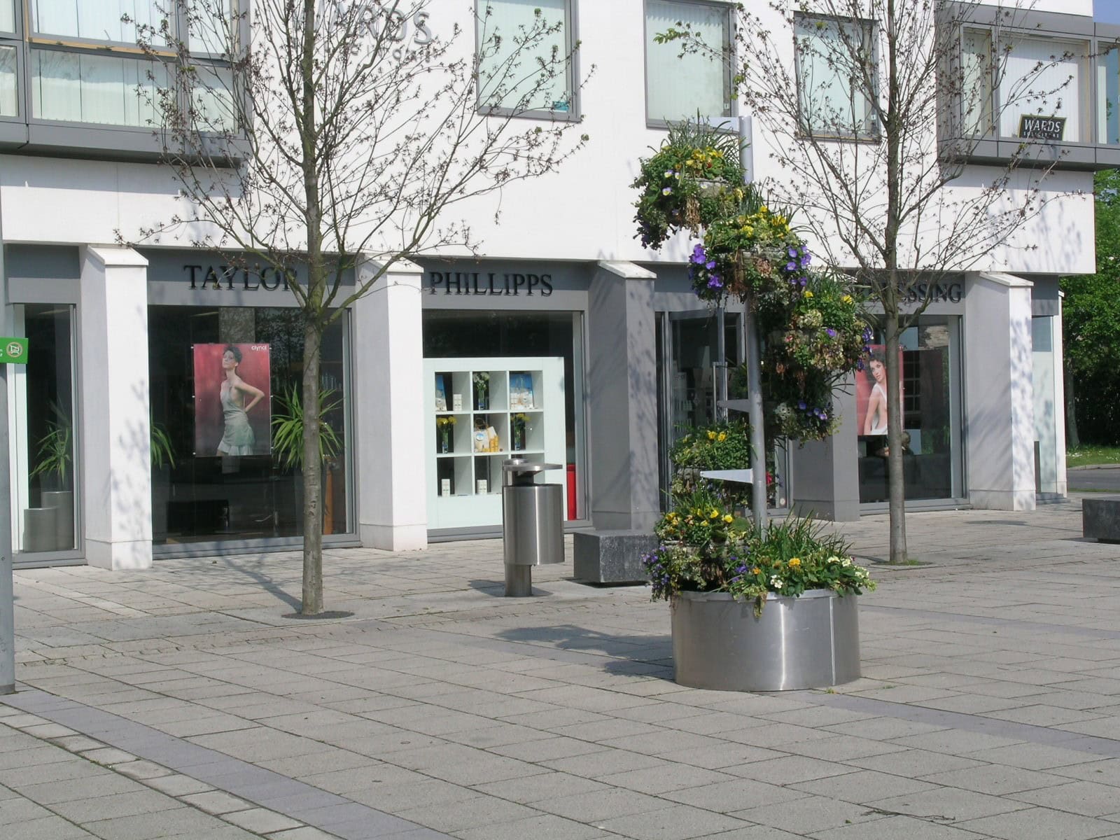
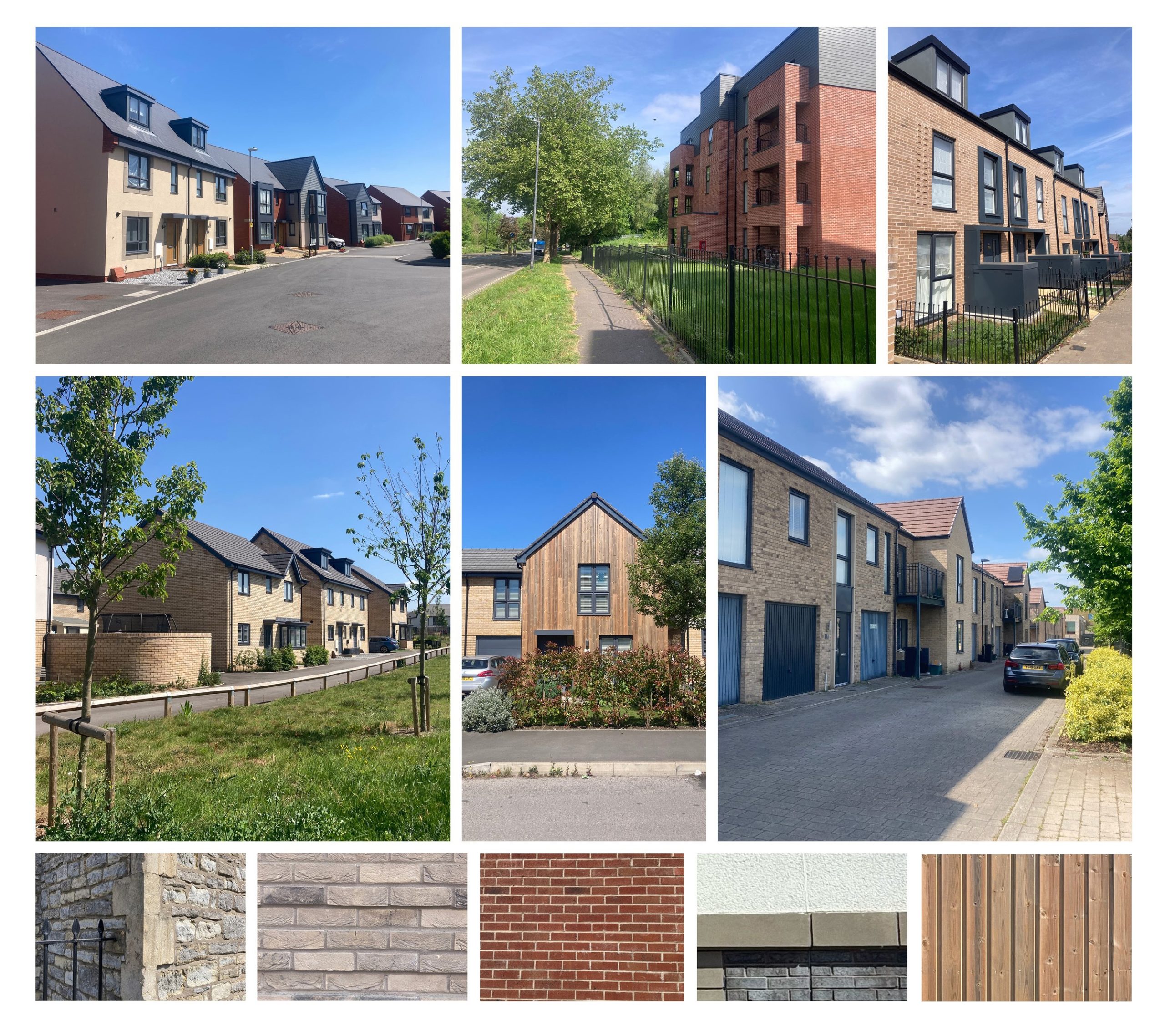
High quality design
- Creation of a high quality, attractive neighbourhood with its own character
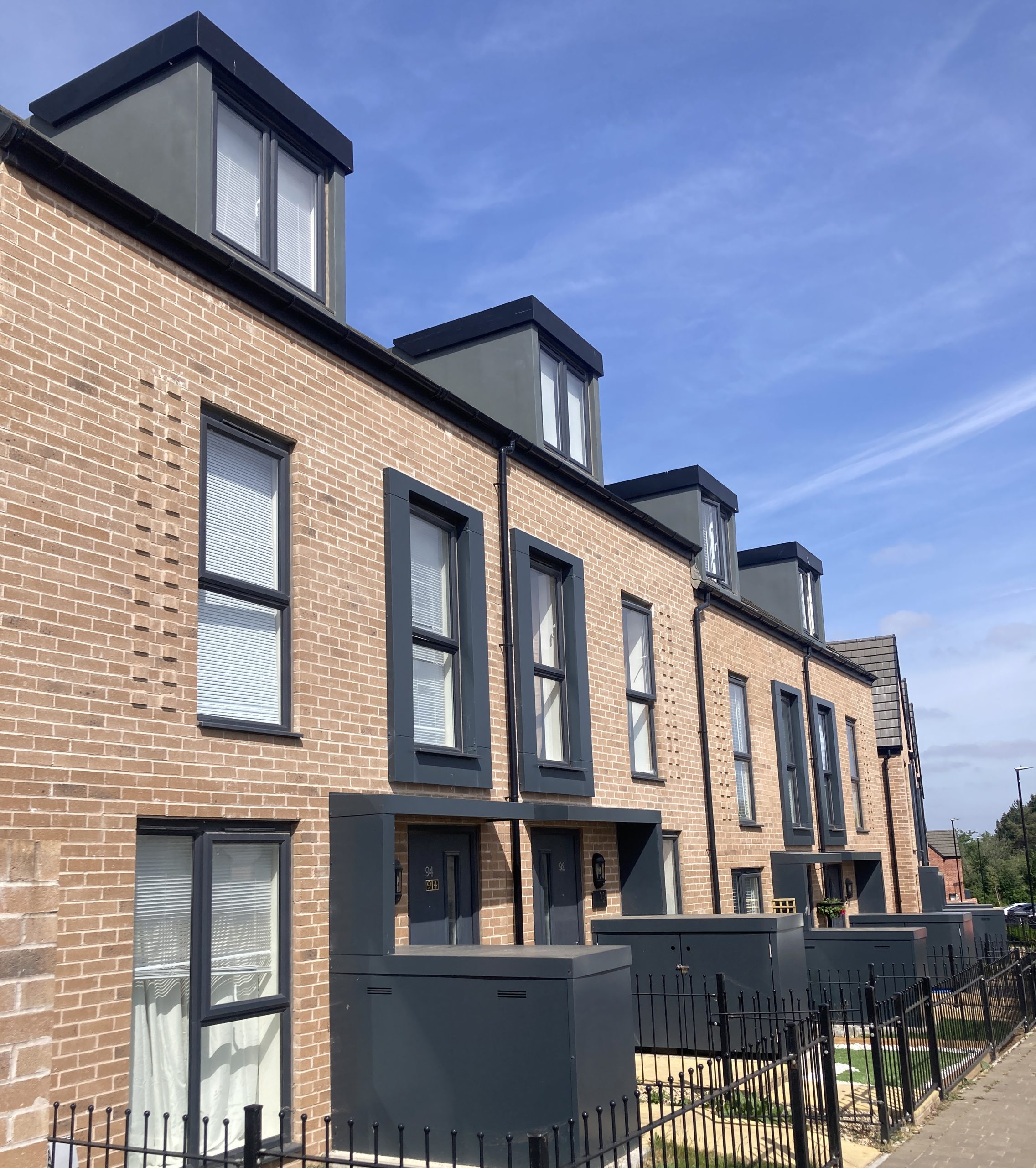
- Design of homes inspired by the local area e.g. stone, red or buff brick and wooden cladding
- Density appropriate for the site’s location and reflecting the surrounding area
- A wide mix of house types and sizes to cater for a wide range of housing needs
- A mix of building types, including detached, semi-detached, terraced and apartments
- This is an outline planning application that only covers the key principles of development. All detailed designs will follow at the next stage, the Reserved Matters application
Sustainable and energy – efficient homes
- All buildings will meet the latest sustainability standards prescribed through the Building Regulations
- As this is an outline planning application, details such as onsite renewables and electric vehicle charging will be addressed at the subsequent ‘Reserved Matters’ stage.
Transport & movement
Our emerging transport strategy has been designed to support the delivery of B&NES’ Creating Sustainable Communities – Whitchurch Village Transport Strategy. Our approach seeks to build a community with a sustainable, inclusive, and future-ready network of transport routes at its heart. These will be based on walkable neighbourhood principles, connecting and integrating with Whitchurch, promoting healthy lifestyles and sustainable travel opportunities. Our transport and movement strategy will ensure our proposals improve transport conditions for both existing and future residents.
Vehicle access
- Vehicle access to the site will be provided:
- from the south via the A37 – signalising the A37 Bristol Road / Woollard Lane junction, providing a safer access to Queen Charlton Lane and diverting Woollard Lane into the site – significantly improving capacity and the flow of traffic
- from the north via Staunton Lane, with a new raised table priority-T junction approx. in the location of the current Horseworld access
- Potential to reduce congestion at the A37 / Staunton Lane / Church Road junction by removing the right-turn into Staunton Lane
- A new road through the site between Woollard Lane and Staunton Lane will accommodate this wider redistributed traffic. This will be designed to the highest standards for pedestrians and cyclists, and located away from the new local hub and primary school, to ensure a more pleasant environment and safer movement for all users
- We will have full discussions with the council’s highways officers once the application is submitted, to establish and confirm access arrangements and improvements to off-site roads and junctions
- EV charging will be provided at new homes, as well as visitor charging stations at the Mobility Hub, alongside e-car-club hire, e-bikes and e-scooters
![250292 Transport And Movement Strategy Issue02[37]](/wp-content/uploads/2026/06/250292-Transport-and-Movement-Strategy_Issue0237.jpg)
Healthy & active travel
- By locating the new primary school, shops, community facilities and mobility hub in the heart of the new community – with safe links for existing residents – our proposals will encourage and support less travel
- Segregated cycle routes, footways and ‘modal filters’ (which limit or restrict vehicles), will help promote walking and cycling for all users
- The new local community centre will be easy to walk or cycle to. This is where residents will also be able access sustainable travel options, including e-bikes, e-scooters or rent an e-car-club car at the Mobility Hub. We are also ensuring there is access and space for school drop-off
- Signalised crossing over A37 Bristol Road and shared foot/cycleway connection to Norton Lane, to make it safer to walk and cycle to the playpark, allotments, cricket club and National Cycle Network (NCN) to the south
- Potential restriction to vehicles accessing Sleep Lane to remove through traffic, making it safer to walk and cycle, and support wider Whitchurch Liveable Neighbourhood ambitions
- Proposed walking and cycling improvements along Staunton Lane, including at the site access
- Restricting vehicle movements (through a ‘shuttle’ arrangement where traffic if forced to turn take) on a short section between Hamilton Way and the Whitchurch Railway Path (NCN3) will help keep traffic speeds low and provide a safe connection for pedestrians and cyclists
- Incorporating Queen Charlton Lane Liveable Neighbourhood and Public Rights of Way (PRoWs) through site, enabling access to existing community and countryside, including towards Queen Charlton & Keynsham
User-friendly public transport
- Our emerging public transport strategy seeks to improve access to a range of destinations for existing and new residents
- Improvements to off-site bus stops on A37, together with on-site mobility hub / bus stops
- The majority of new homes would be within a five minute walk of bus shelters with on-screen, live information
- The following bus service options are currently being considered:
- Expansion of the WestLink DRT to include the site within the Hengrove shared zone
- Service extensions of existing bus services routing through Stockwood, including service 2 (to/from Bristol and Cribbs Causeway) and the 515 (to/from Asda, Hengrove Park and Imperial Park)
- Access to service along the A37, including 172, 374, 375 and 376 (to/from Bristol, Wells, Midsomer Norton, Glastonbury, Street, Bridgwater, Taunton and Bath)
- A new east-west mini-bus service operating from Keynsham – Hengrove Park, via Stockwood and Whitchurch. Whilst this would only be a few services per day, services could be timed to interchange with train times at Keynsham rail station
Protecting heritage assets
No designated heritage assets (listed buildings, scheduled monuments, conservation areas) within the site boundary
The development would not impact any heritage assets outside of the site, notably the Queen Charton Conservation Area nor Maes Knoll
Archaeological investigations, including geophysical surveys and trial trenching, have confirmed that there are no archaeological remains within the site that would need to remain in situ and those will be investigated further and recorded in due course as part of the development.
Flooding and drainage
- Site located within Flood Zone 1 (very low probability of flooding) with some small, isolated pockets of land subject to surface water flooding
- Initial investigations indicate the site can accommodate Sustainable Urban Drainage Solutions (SUDS) to appropriately control the speed and quality of surface water run-off from the proposed development
- Comprehensive Drainage Strategy and Flood Risk Assessment being prepared and submitted with the planning application.
Jobs, social & economic benefits
- Circa 140 direct full time construction jobs
- Circa 76 full time jobs created through the local centre and primary school
- A significant proportion of affordable homes
- Circa £2.2 million in annual council tax
- Circa £13.2 million in Community Infrastructure Levy Charge
- Creation of circa 37ha of open space, including play spaces and a community orchard
- Land for a primary school with a capacity for up to 420 students
Construction
Construction Environmental Management Plan (CEMP) will address areas such as hours of work, areas on site for construction parking and deliveries, noise, vibration, dust, light spill etc.
A condition of the planning permission will require submission and approval of the management plan by the Council prior to commencement of development.
All materials and plant storage are likely to be held on site
Anticipated development would be in stages, allowing earlier phases to be completed and occupied while subsequent phases are constructed
What next
While our 24 June event went ahead, we appreciate the Met Office’s red weather warning meant that some people who would like to have attended our consultation event were not able to. So, we will now be arranging a second event in the coming weeks. We will share further details as soon as we are able to set a date.
We appreciate any feedback you can provide. We will review all comments and include a summary of them in our Statement of Community Involvement report which will accompany the application. The feedback received from our second event – as with all feedback – will form part of our engagement with council officers and other stakeholders once our application is submitted: this is the most effective way to ensure that community input is considered as we progress through that process.
As previously stated, please note this is an outline planning application only, which seeks to agree the principle of development. All detailed matters will be agreed through subsequent reserved matters application. The community will be consulted again on any future detailed applications.
While we will be submitting the application in July, we cannot be certain if and when planning permission is granted, nor if and when the draft Local Plan is adopted. However, our best estimate would be that the first homes could be occupied in 2028/29.
Get in touch
If you have any questions, you can:
- Submit them via the feedback form
- Email: [email protected]
- Call: 0800 193 9403